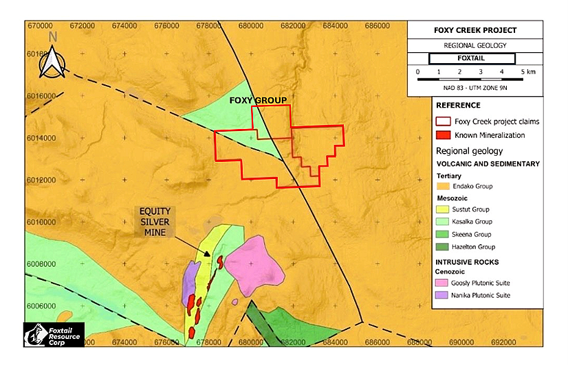
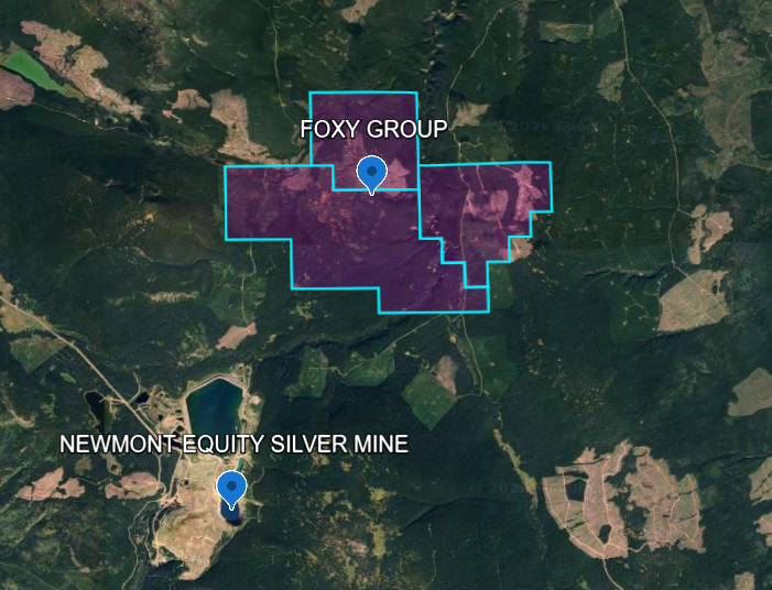
Foxy Creek Group 1,568.69 hectares
The Foxy Creek Group is located in the Buck Creek volcanic belt, approximately 1.5 km northeast of Newmont’s past producing Equity Silver Mine, and covers the Benamy occurrence (MINFILE 093L 331). The claims sit on strike with Equity’s main ore zones and are underlain by the same Eocene Endako Group volcanics (Buck Creek and Goosly Lake formations) that host the Equity deposit. Equity produced approximately 71 million ounces of silver, 508,000 ounces of gold, and 185 million pounds of copper between 1981 and 1994. (At Equity two of three main ore bodies mined out; Waterline Zone remains.) The property also benefits from existing regional magnetic data and potential infrastructure synergies with the nearby Equity mine site.
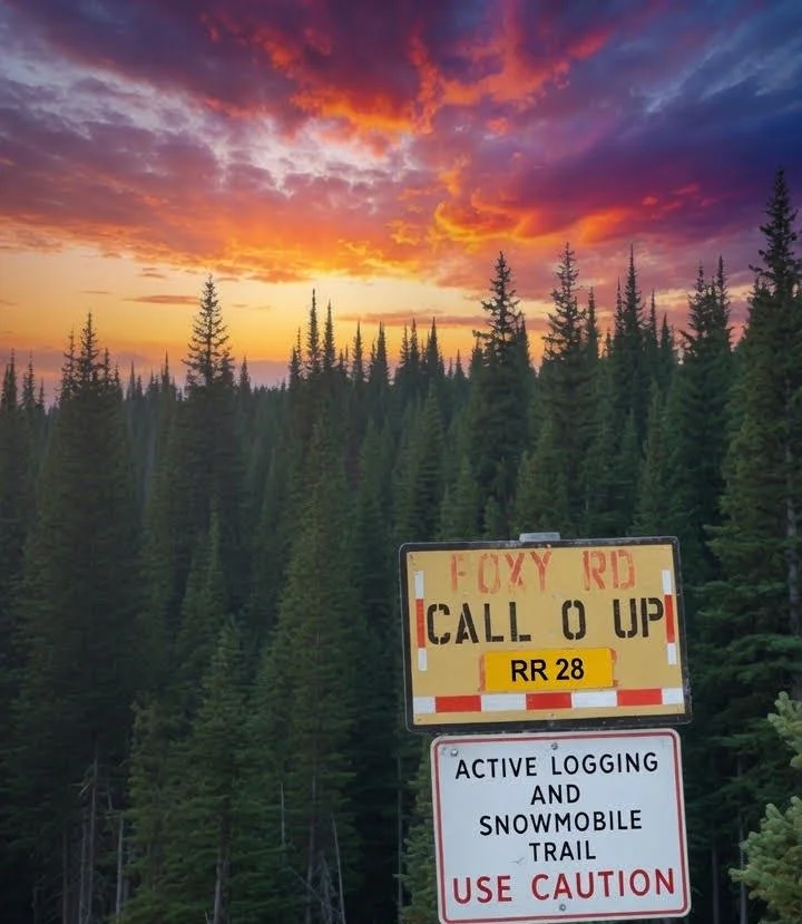
The Bulkley River starts at Foxy Creek. Early pioneers and miners followed the river upstream from steamships in Hazelton to reach Foxy Creek, east of Houston. It is the author’s unverified belief that Foxy Creek got its name from the attractive pan concentrates prospectors found there, with the reddish bedrock colours in the creek adding to the striking, “foxy” appearance of the gravels.
In 1969, Frontier Explorations Ltd. completed a line cutting program on Claim Nos. 1-30 in the Goosley Lake area (Hachey). The soil sampling grid completed in the present program was run over the same area. The author was unable to locate any subsequent geochemical or geophysical results arising from that line-cutting effort.
Notable earlier work by Frontier Explorations Ltd. in the broader district includes considerable trenching and some drilling on the Cole Lake veins in 1967 (the company had acquired ground in that area in 1960 and completed minor work in the early 1960s). That activity is associated with the Silver Queen deposit (MINFILE 093L 002) and is geographically unrelated to the Foxy Creek claims, but remains regionally important historical context for the Goosly Lake / Equity Silver camp.
In 1973, the British Columbia Department of Mines and Petroleum Resources published regional maps covering the project area under the title Geology of the Buck Creek Area by B.N. Church. These maps identify Eocene volcanic rocks (cited as Goosly Lake and Buck Creek volcanic rocks) and Cretaceous volcanic rocks (cited as Tip Top Hill volcanic rocks) (Church, B.N., 1973). A later, more comprehensive synthesis of the geology, lithogeochemistry and mineralization of the Buck Creek area was published by B.N. Church and J.J. Barakso in 1990 (Paper 1990-2).
In 1981, the area was explored by Shell Canada Limited as the Foxy Creek Project and included regional induced polarization and geochemical surveys.
In 1985, Falconbridge Copper completed a series of DEEPEM surveys, resulting in the report of two anomalies and a proposal to drill them. The report also mentioned the possible extension of the volcanic units that host mineralization at the Equity Silver Mine below ground within the current Foxy Creek Project area (Falconbridge Copper original interpretation map and corresponding cross-section from this conclusion are shown in Figure 3).
Later in 1985, three diamond drill holes totalling 676 metres were completed to test a DEEPEM survey anomaly and to establish the depth to the Hazelton Group. The holes were reported to reach the Equity Silver Mine’s Goosly sequence of rocks but failed to intersect any significant mineralization. The best intersection returned 2.06 grams per tonne silver a cross 1.2 metres (Lefebure, D., 1985b). No further work
During 2022, Finlay Minerals Ltd. conducted a soil sample program in areas of the Silver Hope project immediately adjacent to the Foxy Creek claims. Soil samples taken next to the southwestern border of the Foxy project returned anomalous silver values, with some samples exceeding 1.5 ppm Ag (Finlay Minerals Ltd. 2023 corporate presentation). As of November 2025, Finlay’s website reports no major new activities on Silver Hope beyond ongoing data compilation and target generation.
In 2023–2024, Palmer Environmental Consulting Group prepared a high resolution LiDAR-derived surficial geology and till sampling suitability map for Finlay Minerals Ltd. over a ~213 km² area of interest covering the Silver Hope Property (Sacco et al., 2024; presented in Assessment Report 42047). Portions of these maps also cover the Foxy Silver claim. Palmer was retained to acquire LiDAR and imagery and to provide a foundational understanding of the surficial geology to support evaluation of existing geochemical data and planning of future surface, base-of-till, and top of bedrock sampling on this drift covered property. Class 1 polygons on the map indicate areas of entirely subglacial till that are highly suitable for systematic sampling